PANORAMA AMBIENTAL DA MICRO BACIA DO IGARAPÉ GRANDE (The environmental panorama of the micro watershed of igarapé Grande)
DOI:
https://doi.org/10.5654/acta.v4i7.234Resumo
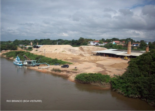
A cidade de Boa Vista, capital do Estado de Roraima, está situada à margem direita do rio Branco, no centro Leste do Estado. Sua rede hidrográfica possui como principal manancial o rio Branco, constituído por sub-bacias com diversos canais de primeira ordem. Dentre estas sub-bacias destacam-se as dos igarapés Grande, Pricumã e Mirandinha. A micro-bacia do igarapé Grande localiza-se em sua totalidade na área urbana de Boa Vista. Até meados da década de 80 do século XX, sua mata ciliar não apresentava grandes alterações e sua margem era ocupada por práticas agrícolas de subsistência em sítios familiares, que abasteciam uma pequena parcela populacional da região circunvizinha. Porém, com o processo de imigração registrado a partir de 1980 a situação mudou completamente em relação aos impactos sócio-ambientais. Assim, o presente trabalho visa traçar um diagnóstico sócio-ambiental da micro bacia do igarapé Grande. Para alcançar os objetivos propostos utilizamos técnicas de sensoriamento remoto, inspeção em campo, consulta em órgãos públicos que trabalha com a temática, bem como leitura de textos, artigos e livros que tratam do assunto com o desígnio de identificar e propor recomendações para a solução dos problemas sócio-ambientais ali existentes. Palavras-chave: meio ambiente; cidade; espaço urbano; recursos hídricos. ABSTRACT The city of Boa Vista, the state capital of Roraima, is located on the right bank of the River Branco, in mid-east part of the state. Its hydrographic network has the River Branco as its main fountainhead, consisting of sub-watersheds and several first-class channels. Among these sub-watersheds, those of the Grande, Pricumã and Mirandinha Igarapés stand out. The micro-watershed of the Grande Igarapé is entirely located within the Boa Vista urban area. Until the middle of the 1980s, its riparian vegetation had not been greatly impacted and its banks were occupied by subsistence agricultural activities on family-owned plots, which supplied staples to a small part of the population in the surrounding region. However, with the process of increased immigration that took place from the 1980s onwards, the situation changed completely with regards to the socio-environmental impacts on the area. Thus, the purpose of this study is to outline a socio-environmental diagnosis of the Grande Igarapé micro-watershed. In order to reach the intended objectives, we have used remote sensing techniques, field inspections, consultation with government entities that deal with the issue, as well as research of texts, articles and books that cover the subject with the purpose of identifying and proposing recommendations for the solution of existing socio-economic problems. Keywords: environment; city; urban center; hydro-resources. DOI: 10.5654/actageo2010.0407.0013Downloads
Downloads
Publicado
Edição
Seção
Licença
PORTUGUÊS A Revista ACTA Geográfica deterá os direitos autorais dos trabalhos publicados. Os direitos referem-se a publicação do trabalho em qualquer parte do mundo, incluindo os direitos às renovações, expansões e disseminações da contribuição, bem como outros direitos subsidiários. Os(as) autores(as) têm permissão para a publicação da contribuição em outro meio, impresso ou digital, em português ou em tradução, desde que os devidos créditos sejam dados à Revista ACTA Geográfica.
ENGLISH ACTA Geográfica Journal will obtain the auctorial rights for all published texts. This also implies that the text can be published anywhere in the world, including all rights on renewal, expansion and dissemination of the contribution, as well as other subsidiary rights. The author’s get permission to publish the contribution in other medias, printed or digital, itmay be in Portuguese or translation, since the publication is credited to ACTA Geográfica Journal.

Este obra está licenciado com uma Licença Creative Commons Atribuição 4.0 Internacional.


